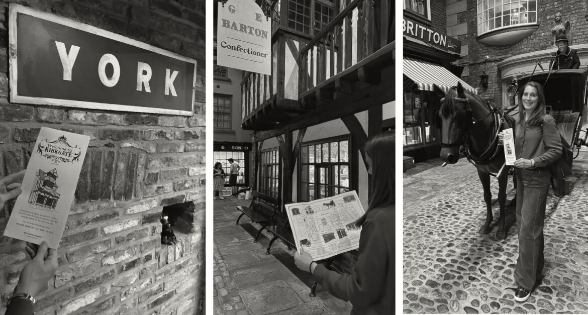
York Castle Museum - Kirkgate Victorian Street Map
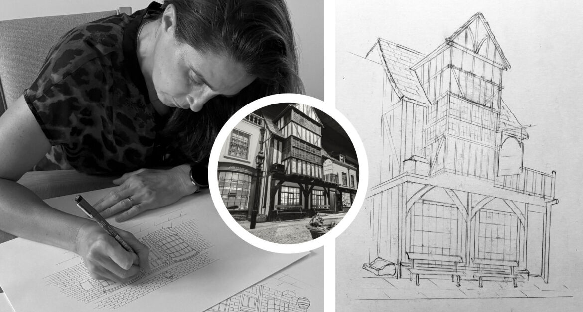
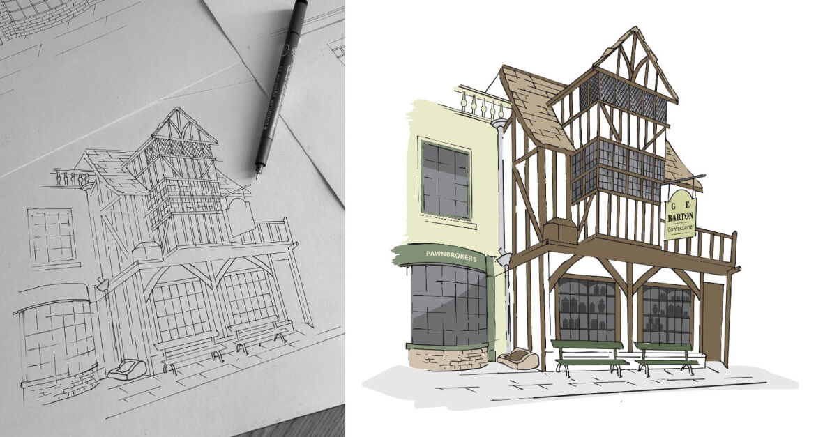
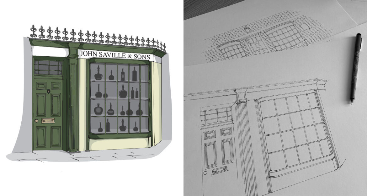
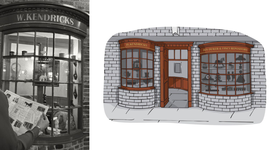
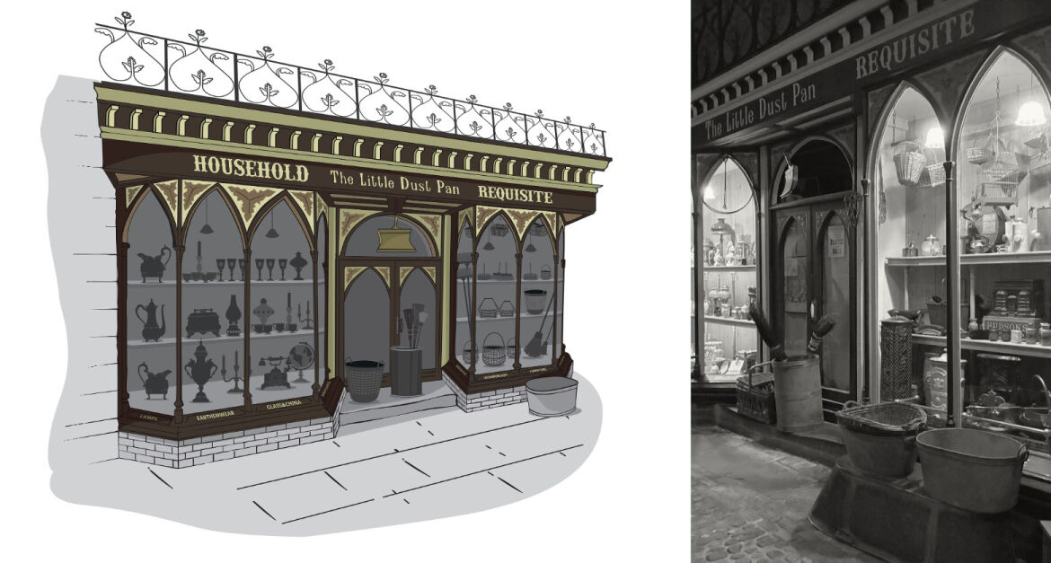
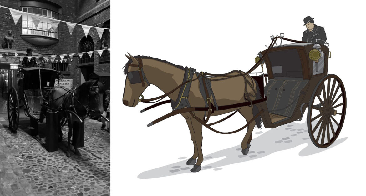
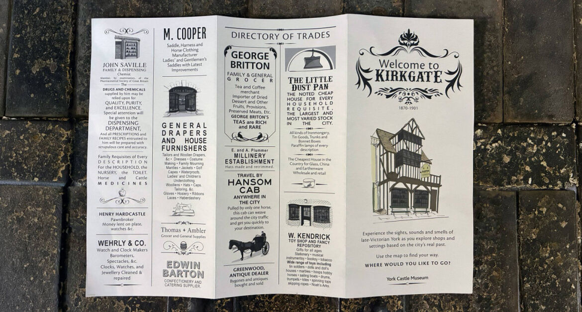
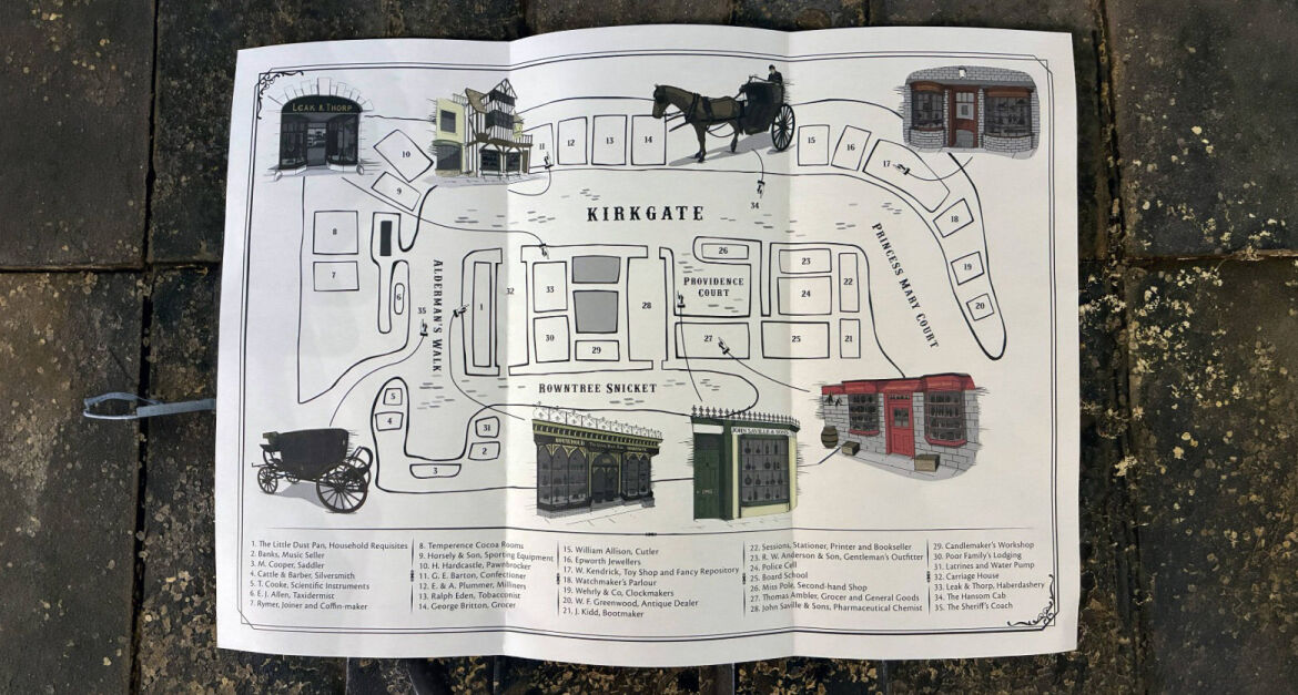
York Castle Museum invited tenders to design and produce a Victorian tourist-style map of Kirkgate. The map was for the use of their visitors to provide them with an orientation of the street, a means to explore Kirkgate and information about specific shops and merchants. and guess what… Ellen got the job and headed to the cobbles… Kirkgate is a recreated Victorian street at York Castle Museum. It uses shop and shop front displays based on real merchants and businesses that operated in York between 1870 and 1901, alongside experiences grounded in real history. The brief was to illustrate the map in a Victorian style and be attractive, inviting, clear and easy-to-use tourist map. It had to be keeping with a late-Victorian design aesthetic while maintaining modern accessibility requirements. The map was produced to unfold to show the map on one side and a directory of trades on the other. The directory of trades consists of a selection of historically inspired ‘advertisements’ for some of the featured locations, based on York’s Victorian trade of directories. To create the map, Ellen visited Kirkgate and took photographs and videos to gain a comprehensive understanding of the street. Ellen then created bespoke hand-drawn illustrations of a selection of shops, including the Hansom Cab and The Sheriff’s Coach and then created them into digital form. This was a unique opportunity as these shops had never had such a detailed representation created.